Maps Masterclass, Subsection I (Part II of Navigation Guide)
Types, Scale, Latitude and Longitude, Coordinates
We continue to move through the Scout Level I skillsets that will give you and your community the ability to operate in the field. Whether you’re on a reconnaissance mission, a supply run, or just honing your skills, mastering diurnal navigation techniques is your first step to becoming a proficient navigator in any scenario.
Maps are the bread and butter of navigation, whether you're in the thick of the wilderness or cruising through urban sprawl. So, let’s break down the types of maps you’ll encounter in the field and get you squared away on how to use them.
Why Paper Maps?
Become familiar with how to use them, even if you’ll wind up using GPS devices. There are a number of reasons for this. It’s a good backup incase the GPS device breaks, doesn’t get signal, or runs out of power. Paper maps are also great for really understanding navigation elements better. Finally, devices make light, heat, and are trackable. Depending on the scenario, being invisible might be part of the objective. Using paper maps eliminates that risk.
Types of Maps
Topographic Maps (Topo Maps)
These are the go-to for most field operations. Think of topo maps as the Earth's skin, detailed with all its wrinkles, dimples, and tattoos. They show you the lay of the land—hills, valleys, rivers, and lakes—with contour lines to represent elevation. These are your eyes in the sky when you’re planning to maneuver through terrain where knowing your ups and downs can make or break your mission. In this guide, we will dive deep into how to read and utilize the information they contain to move you through terrain.
Road Maps
While they might not be as detailed in the natural landscape department, road maps are your navigational bread when it comes to urban or developed areas. They highlight highways, streets, and alleys, giving you the intel you need to navigate from point A to B without getting tangled up in dead ends or unexpected one-way streets. Essential for any operation or journey that involves a bit more asphalt than dirt.
Thematic Maps
Here’s where we get a bit specialized. Thematic maps are all about focusing on specific information—climate zones, population density, or even the distribution of certain plant species or water availability. Useful for when your mission or adventure has particular needs or considerations, like avoiding heavily populated areas or finding a water source in dry regions.
Digital Maps
Welcome to the 21st century, where your map folds up neatly into your pocket-sized smart device. Digital maps are incredibly versatile, offering real-time data, the ability to zoom in for extreme detail, and often, satellite imagery. Plus, many digital mapping tools allow you to layer different types of information, making them a powerful asset in both planning stages and real-time navigation. It’s important not to solely rely on them however, because of their dependence on power.
It is crucial that a scout know how to navigate with traditional paper map and compass. I strongly encourage you to become intimately familiar with these techniques. We’ll cover it all on this site.
Each type of map has its unique role and strength, and knowing which map to pull out of your pack or access on your device can be the key to successful navigation. So, familiarize yourself with these maps, understand their languages, and you’ll be well on your way to leading the pack, no matter where you’re headed. Let's get you comfortable with these so you can navigate any terrain like a pro.
Components of a Map
Title
The title is the map's introduction, giving the user immediate insight into the focus or coverage of the map. It can often indicate the geographic region, the subject matter (such as a political boundary or the distribution of a species), or the purpose of the map (like a hiking trail map).
Border
The border frames the map content, clearly delineating the edge of the map area from the surrounding information or margin. It helps to focus the user's attention on the relevant information and often contains important details like the map's scale, orientation, and legend.
Orientation
Maps are traditionally oriented with north at the top. The map's orientation is usually indicated by a north arrow or a compass rose, which informs the user of the map's alignment with the cardinal directions. This is crucial for correctly relating the map to the real world when navigating.
Legend (or Key)
The legend is a decoder ring for the map. It explains the meaning of symbols, colors, and line styles used on the map, allowing the user to understand the represented features such as roads, trails, water bodies, and elevation changes.
Scale
This is the map's way of breaking down distances in a way that makes sense to us on the ground. It’s like translating the giant steps of the terrain into manageable paces we can comprehend and measure. Get this under your belt, and you'll be able to estimate distances and plan your movements with precision.
Contour Lines
Contour lines are next-level intel. These lines connect points of equal elevation, giving you a 3D picture of the terrain flat on a 2D surface. They can tell you where the high ground is for observation or defense and where the valleys lie for cover and concealment. Reading contour lines lets you visualize the terrain, planning your routes to take advantage of the lay of the land, avoiding unnecessary uphill battles, and staying out of sight.
Source
This often-overlooked component is crucial for assessing the map's reliability and currency. The source tells you who created the map and when, which can affect the map's accuracy and usefulness. A map drawn for historical interest, for example, may be less useful for current navigation.
Reading a Map
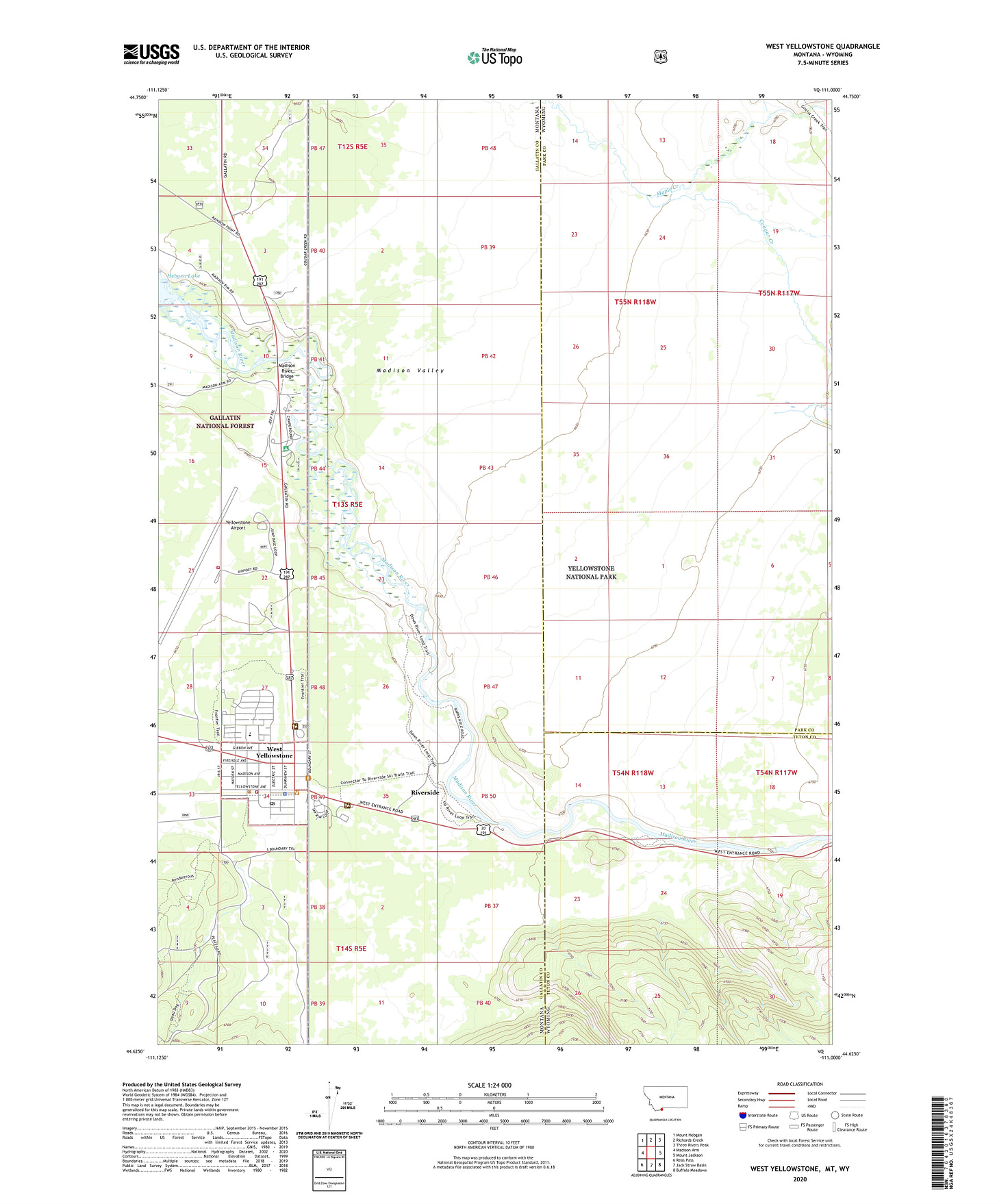
We will be using this topo map for reference as we discuss the components of a map. Feel free to open it in a new tab, or download it and zoom in to see elements close up.
What does the title tell us?
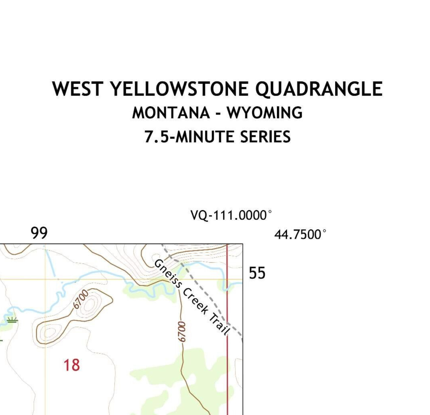
In our sample map, the title is in the upper right hand corner and contains several pieces of important information typical for the title section of a topographic map, especially those created by organizations like the U.S. Geological Survey (USGS). Here's what each part of the title indicates:
West Yellowstone Quadrangle: This specifies the area that the map covers. A quadrangle in mapping terms is a rectangle of the Earth's surface that's bounded by lines of latitude and longitude. West Yellowstone indicates the primary named geographic area covered by the map, which in this case is the region around the town of West Yellowstone.
Montana - Wyoming: These are the states that the West Yellowstone Quadrangle straddles. Including the names of the states helps users quickly identify the general region the map pertains to and is essential for orienting the map within a larger national context.
7.5 Minute Series: This denotes the map scale and the scope of coverage. Each map in the 7.5-minute series covers a land area delineated by 7.5 minutes of latitude and 7.5 minutes of longitude (covered in detail below), which equates to approximately 1:24,000 scale. This means that one inch on the map represents 24,000 inches in the real world. The "7.5-minute" part of the title is significant for indicating the level of detail and area size that the map represents, and it's a standard size for topographic maps, providing detailed coverage that's useful for a wide range of activities, from hiking and camping to land use planning.
Understanding Scale
Keep reading with a 7-day free trial
Subscribe to Collapse Curriculum to keep reading this post and get 7 days of free access to the full post archives.


